Milton Keynes becomes flood city after Storm Henk causes chaos to water levels
and live on Freeview channel 276
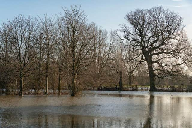
Yesterday’s Storm Henk caused parks to resemble lakes in parts on Milton Keynes while gardens in some areas are underwater.
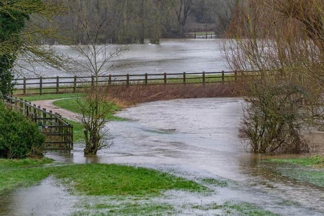
The Park’s Trust has issued a warning for people to take extra care and stay out of the flood water until the levels subside.
Advertisement
Hide AdAdvertisement
Hide AdThe city’s green spaces are designed as flood defences to hold excess rainwater to help prevent residential flooding. And all the lakes in MK are manmade, with most designed as balancing lakes to reduce peaks of river flow.

When there is heavy rainfall, water from the River Ouzel is diverted into Willen Lake and Caldecotte Lakes to reduce the amount of water flowing through the river and lessen the risk of flooding.
Meanwhile, Furzton Lake, Lodge Lake and the Teardrop Lakes are balancing lakes within the Loughton Brook.
The Parks Trust has issued photographs showing chunks of city parkland that were underwater yesterday. A spokesperson said: “Many areas of our parks fall within and have helped to preserve the natural floodplains of our river valleys. We expect to see these park areas in flood during the winter months and the planting and habitat management that we do around these areas take account for this.
Advertisement
Hide AdAdvertisement
Hide Ad“The Floodplain Forest Nature Reserve, Stony Stratford Nature Reserve and the Mill Fields at Stony Stratford flood with water from the River Great Ouse and much of our parkland in Simpson, Woughton and Woolstone floods from the River Ouzel. This means that part of the parks and paths are inaccessible at times during the year.
"This is normal and it means that the floodplains are doing their job. We wouldn’t have such large beautiful parks in MK if it weren’t for their purpose of preventing floods.”
Many of the newer developments have local SUDS (Sustainable Drainage Systems) designed into their plans. These often form the heart of the park and the housing development is built around them. Examples are Brooklands Meadows and Oxley Park, which for parts of the year look like dry ditches but when heavy rainfall comes, water that runs off from roads, paths, car parks and roofs is stored in them, creating a series of brooks and ponds.
This means that the excess water runs away from the houses and prevents residential flooding, says The Parks Trust
Advertisement
Hide AdAdvertisement
Hide AdBut older towns in MK do not fare so well. In Newport Pagnell the River Ouse regularly causes flooding near homes, particularly in Mill Street, the Rivers Estate and Little Linford Lane. Both Riverside and Little Linford Lane had to be closed to traffic yesterday (Tuesday).
Yardley Road in Olney was also closed due to “unsafe” water levels, but reopened later in the day.
The Met Office issued an amber weather warning for wind and rain yesterday due to Storm Henk, which brought winds of up to 80mph in some parts of the UK, causing disruption to travel and utilities.
Now the weather is expected to remain unsettled for a few more days, with the risk of rain “never too far away”, say Met Office experts..
The Environment Agency and Anglian Water are responsible for maintaining the flood defences in Milton Keynes. In the case of an emergency, you can contact them on 0845 988 1188.